From Thunderstorms to Solar Storms
By Patrick L. Barry
When severe weather occurs, there's a world of difference for people on the ground between a storm that's overhead and one that's several kilometers away. Yet current geostationary weather satellites can be as much as 3 km off in pinpointing the true locations of storms.
A new generation of weather satellites will boost this accuracy by 2 to 4 times. The first in this new installment of NOAA's Geostationary Operational Environmental Satellites series, called GOES-N, was launched May 24 by NASA and Boeing for NOAA (National Oceanic and Atmospheric Administration). (A new polar-orbiting weather satellite, NOAA-18, was launched May 2005.)
Along with better accuracy at pinpointing storms, GOES-N sports a raft of improvements that will enhance our ability to monitor the weatherboth normal, atmospheric weather and space weather.
Satellites eventually wear out or get low on fuel, so we've got to launch new weather satellites every few years if we want to keep up the continuous eye on weather that NOAA has maintained for more than 30 years now, says Thomas Wrublewski, liaison officer for NOAA at NASA's Goddard Space Flight Center.
Currently, GOES-N is in a parking orbit at 90° west longitude over the equator. For the next 6 months it will remain there while NASA thoroughly tests all its systems. If all goes well, it will someday replace one of the two active GOES satelliteseither the eastern satellite (75°W) or the western one (135°W), depending on the condition of those satellites at the time.
Unlike all previous GOES satellites, GOES-N carries star trackers aboard to precisely determine its orientation in space. Also for the first time, the storm-tracking instruments have been mounted to an optical bench, which is a very stable platform that resists thermal warping. These two improvements will let scientists say with 2 to 4 times greater accuracy exactly where storms are located.
Also, X-ray images of the Sun taken by GOES-N will be about twice as sharp as before. The new Solar X-ray Imager (SXI) will also automatically identify solar flares as they happen, instead of waiting for a scientist on the ground to analyze the images. Flares affect space weather, triggering geomagnetic storms that can damage communications satellites and even knock out city power grids. The improved imaging and detection of solar flares by GOES-N will allow for earlier warnings.
So for thunderstorms and solar storms alike, GOES-N will be an even sharper eye in the sky. Find out more about GOES-N at goespoes.gsfc.nasa.gov/goes .
Also, for young people, the SciJinks Weather Laboratory at scijinks.nasa.gov now includes a printable booklet titled How Do You Make a Weather Satellite? Just click on Technology.
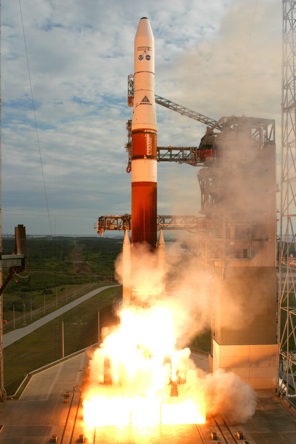
New GOES-N satellite launches, carrying an imaging radiometer, an atmospheric sounder, and a collection of other space environment monitoring instruments.
This article was provided by the Jet Propulsion Laboratory, California Institute of Technology, under a contract with the National Aeronautics and Space Administration.
All content is the responsibility of LUNAR.
If you have comments or suggestions regarding these web pages,
please contact the 
Copyright © 1992 - 2026 LUNAR